Search for a Place:
Route
Manual
Draw
Inspect
Manage
Enter starting point:
Enter ending point:
Starting Time (Default: +10min):
Results in --.--s
1
Shortest Path - A*
ETA --:--
xx.x km
xx.x min
2
Risk Focus - PRP*
ETA --:--
xx.x km
xx.x min
3
Time Focus - PRP*
ETA --:--
xx.x km
xx.x min
4
Energy Focus - PRP*
ETA --:--
xx.x km
xx.x min
Save Flight to DB:
Please fill out this Form before Submitting
Reason/Description for flight:
Selected Flight
xx.x km
xx:xx h
R: xxx
E: xx.x kJ
Back
Save Flightpath
Ups that didn't work
An Error occured, please try again ...
Close
Successful
The Flightpath was successfully commited to the Database. To manage your flights please change to the Flights Application.
Close
Shape info:
Circle
Pos: --.-/--.-
Radius:
Actions:
Block Airspace
Block Airspace Form:
Please fill out all Inputs
Reason/Description for blocking:
Type of Airspace:
Start Datetime:
End Datetime:
Cancel
Block Airspace
Ups that didn't work
An Error occured trying to add the Airspace, please try again later ...
Close
Successful
The Airspace was successfully commited to the Database. To manage your airspaces please change to the Airspaces Application.
Close
Point A:
Point B:
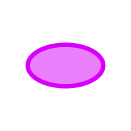
Draw Ellipse
Clear
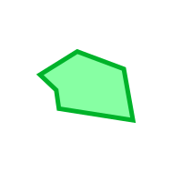
Restricted
Mission
Danger
Help - Planning a Route
Possible Inputs for Start & End Points
Everything from Adresses, Droneport Names & ID's, Airspace Names & ID's aswell as Node ID's can be input. Adresses or Names of Places will be searched in OpenStreetMap and ranked based on what is in view. Therefore searching for 'UKA' when your Map View is displaying Aachen will result in the University Hospital of Aachen.
Input Feedback
To Verify the selected Adress, Droneport, Airspace or Node an Element will appear before the Input field showing an ID of the corresponding Element verifying your selection. In Case you enter an Adress the closest Node to that Adress will be shown next to the Input verifying your selection.
Selecting an Airspace
To select an Airspace you can either fill in the Name or the ID. Both of which you can find out when making airspaces visible in the MapLayers Options and selecting an Airspace. If the Airspace is in Blue color it is available for mission planning.
Shortcuts
AS {ID} -> Airspace
DP {ID} -> DronePorts
ND {ID} -> Node
Help - Airspaces
Restricted Airspace
Restricted Airspaces are fully closed so that no UAV can enter.
Mission Airspace
Mission Airspaces can be included in a planning process as a node in the planning process.
Danger Airspace
Danger Airspaces increase the fly through risk but its not fully closed.
Help - Airspaces Overlap
General Airspace Rules
Different Types of Airspaces can overlap others and certain airspaces cannot overlap others.
- Danger airspaces can be placed everywhere
- Restricted Airspaces cannot be placed intersecting an active mission airspace
- Mission airspaces cannot be placed intersecting an active restricted airspace
- Mission airspaces can be placed intersecting danger airspaces
Additional Rules
Only Mission Airspaces can be selected as a target for route planning